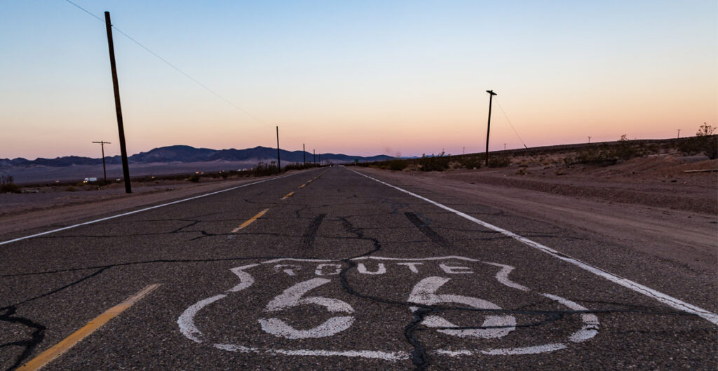
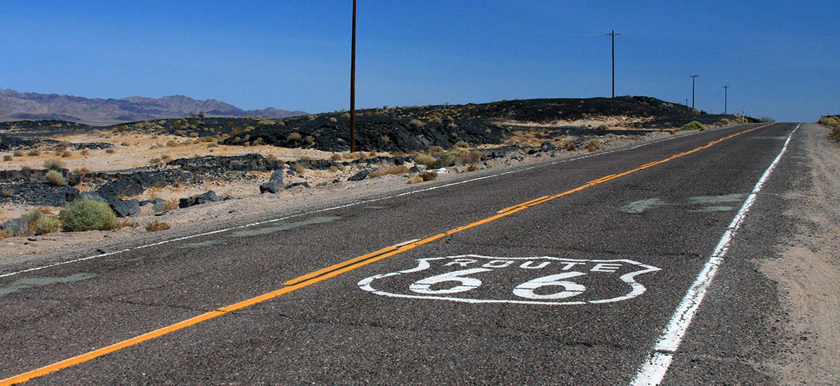
Route 66 is probably one of the most famous roads in the world. Also known as the Main Street of America and the Mother Road, the story of its rise and decline is legendary, so much so that it became the basis of the Disney Pixar movie Cars. Despite large parts of the road being abandoned, a recent resurgence in interest has led to tourists flocking to get their kicks on Route 66 again.
Built in 1926, Route 66 stretched across the USA connecting the Midwest to the Pacific Coast. It spanned over 3,800 km (2,400 miles) and crossed eight states: Illinois, Missouri, Kansas, Oklahoma, Texas, New Mexico, Arizona, and California. The construction of Route 66 was a massive undertaking, involving years of planning, surveying, and building. It played a significant role in the growth and development of the American West. As the Interstate Highway System began to stretch across the country, Route 66 declined in usage with many buildings and communities along its length abandoned.

The idea for a highway connecting Chicago to Los Angeles first emerged in the early 20th century as the popularity of the car began to rise. People were looking for easier and more convenient ways to travel long distances and the idea of a transcontinental highway that would link the Midwest to the West Coast quickly gained support. It was helped along by increased demand to travel between states.
In 1921, the United States Congress passed the Federal Aid Highway Act which provided funding for the construction of a network of highways across the country including Route 66. Before this, auto trails were marked by private organisations across the United States and Canada. The act established that the federal government would provide 50% of the funds to build roads with the states providing the other 50%. It also saw the creation of Bureau of Public Roads, which was responsible for administering the funds provided under the act and overseeing the construction of the highways. The Bureau of Public Roads would later become the Federal Highway Administration, which is still responsible for overseeing the construction and maintenance of the American highways today.
In 1926, the American Association of State Highway Officials (AASHO) created the US Highway System which would assign numbers to routes across the country. Under this system, highways were given one or two digit numbers, with odd numbers generally running north-south and even numbers running east-west. The lowest numbered highways were generally located in the northeast part of the country, while the highest numbered highways were in the west.
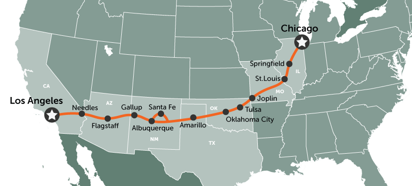
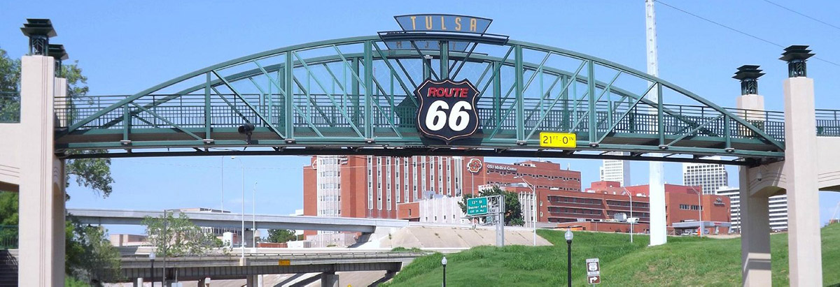
Cyrus Avery, a Tulsa businessman and Oklahoma’s first highway commissioner, spearheaded the creation of the US Highway System. He championed a Chicago to Los Angeles route that dropped south through Oklahoma, then turned west through Texas, New Mexico, Arizona and California. Avery also picked the now famous double sixes as the new road’s official number.
There had already been some precedent for the route Avery had chosen. In 1857, Lt. Edward Fitzgerald Beale, a naval officer in the service of the U.S. Army Corps of Topographical Engineers, was ordered by the War Department to build a government-funded wagon road along the 35th Parallel. Some of this road through Texas, New Mexico, Arizona and California became part of US Route 66. It also featured alignments of other pre-existing trails including the Lone Star Route which passed through St. Louis on its way to Chicago and the National Old Trails Road from St. Louis to Amarillo.
The numerical designation 66 was assigned to the Chicago to Los Angeles route on April 30, 1926 in Springfield, Missouri and construction began in earnest. Teams of surveyors and engineers were sent out to determine the best route for the highway. They faced a number of challenges, including difficult terrain, harsh weather conditions and the need to connect disparate communities along the route. In some cases, the construction of the highway required the acquisition of private land, which could be a difficult and time-consuming process.
Despite these challenges, construction crews worked tirelessly to build the highway. They used a variety of techniques and materials, including concrete, asphalt, and gravel, to create a smooth, durable surface for drivers. They also built bridges and overpasses to help the highway cross rivers, canyons and other obstacles.
The construction of Route 66 was not without its controversies however. Some communities along the route were unhappy with the proposed path of the highway and in some cases, they lobbied to have it rerouted to bypass their towns. Additionally, the construction of the highway displaced many Native American communities who had lived in the area for centuries.
Cyrus Avery called for the establishment of the U.S. Highway 66 Association to promote the complete paving of the highway from end to end and to promote travel down the highway. In 1928, the association made its first attempt at publicity by creating the Bunion Derby. This was a race on foot from Los Angeles to New York City, of which the path from Los Angeles to Chicago would be on Route 66. The race was a massive success and a Cherokee runner named Andy Hartley Payne from Oklahoma won the $25,000 first prize. The U.S. Highway 66 Association also placed adverts in newspapers inviting Americans to take US Route 66 to the 1932 Summer Olympics in Los Angeles.
Traffic grew on the highway because of the geography through which it passed. Much of the highway was essentially flat and this made the highway a popular truck route. The rapidly expanding opportunities in California saw many farming families, mainly from Oklahoma, Arkansas, Kansas, and Texas, moving west for agricultural jobs. The highway was lined with businesses, restaurants, and motels that catered to travellers and it played a significant role in the growth of the American West. During the Great Depression, it provided jobs and economic opportunities for many people and during World War II, it played a key role in the transportation of goods and materials across the country.
The original path of Route 66 was constantly evolving as changes were introduced to eliminate sharp turns, bypass some smaller communities, avoid railroad crossings and to re-route people through major metropolitan areas in order to avoid traffic congestion. Route 66 became the first highway to be completely paved in 1938.
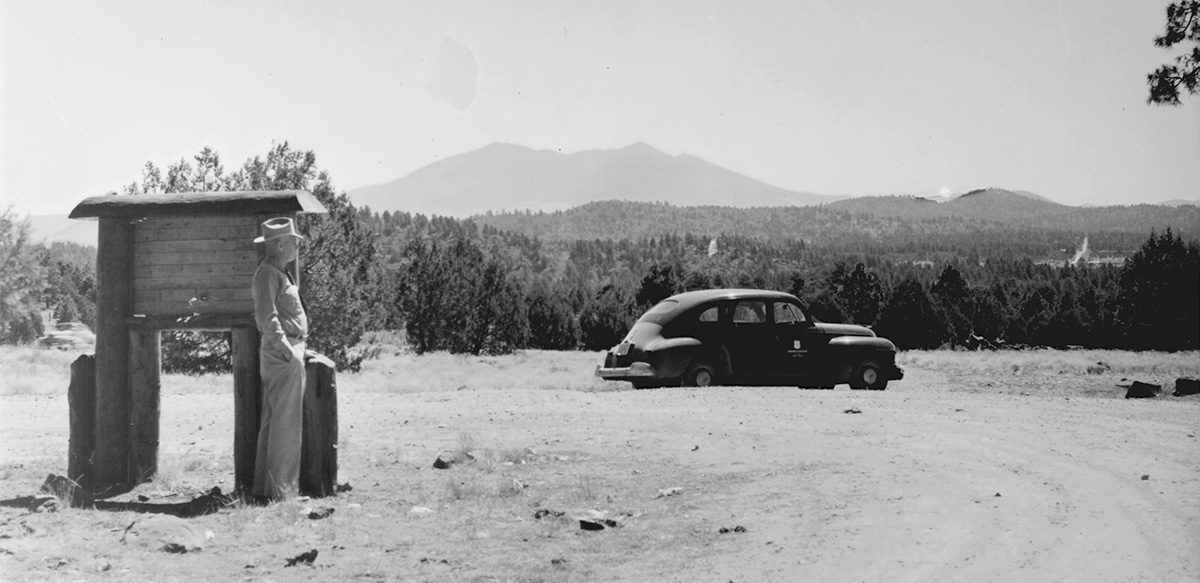
In the 1950s, Route 66 became the main highway for people heading to Los Angeles for vacations. Popular stops along the route included the Painted Desert, the Grand Canyon and Meteor Crater in Arizona. The sharp increase in tourism gave rise to a burgeoning trade in all manner of roadside attractions including teepee-shaped motels, food and drink stands, Indian curio shops and reptile farms. It also marked the birth of the fast-food industry with the world’s first drive through restaurant at Red’s Giant Hamburg in Springfield, Missouri and the first McDonald’s in San Bernardino, California. Route 66 became an American cultural icon spawning the popular song “(Get Your Kicks on) Route 66” and the Route 66 television series which aired on CBS from 1960 to 1964.

The decline of Route 66 can be traced back to 1956 and the signing of the Interstate Highway Act. President Dwight D. Eisenhower was influenced by the German Autobahn network and felt a similar system was necessary for the United States. Efforts were made to realign and modernise Route 66 such as when Illinois widened the route to 4 lanes through the entire state from Chicago to St. Louis bypassing towns throughout the state. Missouri followed suit by bypassing towns and upgrading to four lanes.
In 1953, a major highway opened connecting Oklahoma City and Tulsa, bypassing Route 66 and all towns along the way. This was extended in 1957 to Joplin, Missouri, bypassing the entirety of Route 66 in the state of Kansas. This highway was designated as I-44. In some places where the route had been expanded to four lanes such as in Illinois, the new highways used much of the same roadway rather than being bypassed. The section west of Oklahoma City to the Texas border was initially upgraded to freeway with the addition of extra lanes but this was later bypassed when I-40 was built in 1975.
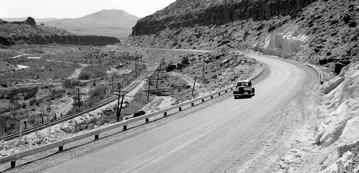
In New Mexico, much of the route was eventually bypassed by I-40 despite pressure from locals who feared the loss of traffic through towns on Route 66. A section between the Texas border and Tucumcari was not bypassed, leading it to become increasingly treacherous due to heavier traffic on the narrow two-lane highway. This stretch became known as Slaughter Lane because of the high number of accidents. Plans to bypass this section were held up due to disagreements on routing between state and federal officials. It would be 1981 before the highway was completed.
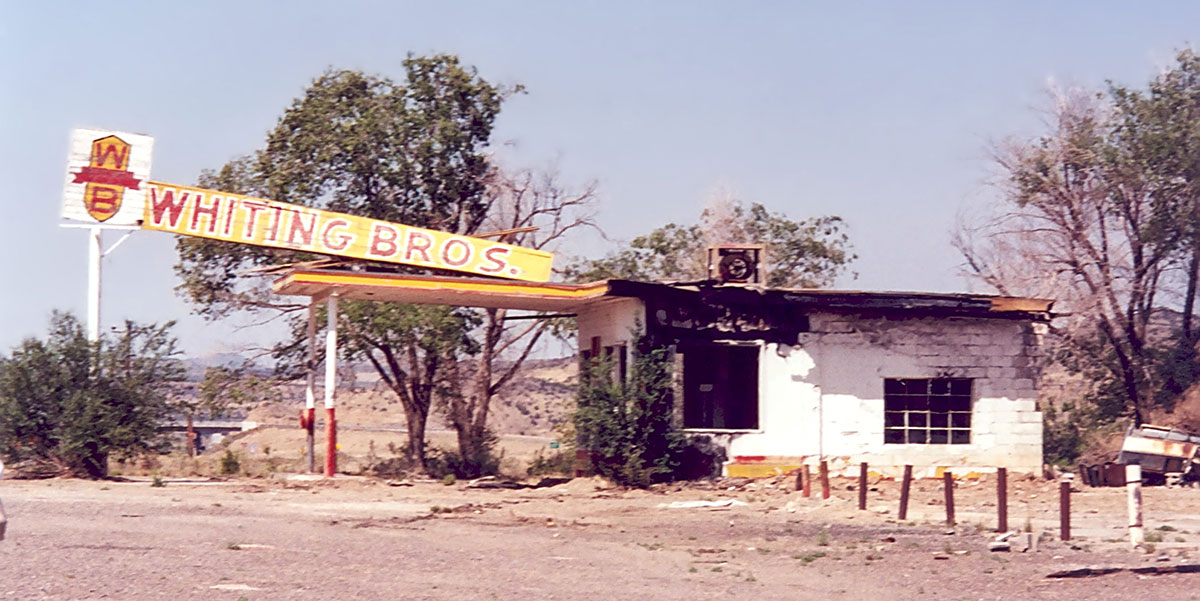
The final stretch of highway bypassing Route 66 was opened in Arizona in 1984 and the following year, the American Association of State Highway and Transportation Officials decertified it. In 1985, Route 66 officially ceased to exist. Over the years, as towns had been bypassed, businesses which relied on the traffic the route brought were closed, despite the best efforts of the US Highway 66 Association. Fear of losing the number resulted in the state of Missouri officially requesting the designation “Interstate 66” for the St. Louis to Oklahoma City section of the route, but it was denied. Motels and restaurants that had once been popular with travellers were now struggling to stay open, and many of the towns along the route began to decline. In some cases, entire communities were abandoned, as people moved away in search of better economic opportunities.

Much of the bypassed route was left abandoned while some sections became state roads, local roads or private drives. Although it is no longer possible to drive US 66 uninterrupted all the way from Chicago to Los Angeles, much of the original route and alternate alignments are still drivable with careful planning. Some stretches are quite well preserved, including one between Springfield, Missouri, and Tulsa, Oklahoma.
In response to the decertification of the route, several groups of enthusiasts, historians, and business owners came together to form associations dedicated to preserving and promoting the history and culture of Route 66. The first Route 66 Association was formed in Missouri in 1989, followed by associations in other states along the route. These associations worked to raise awareness of the importance of Route 66 as a cultural and historical landmark, and to advocate for its preservation and restoration. They also worked to promote tourism along the route, highlighting the unique attractions and landmarks that can be found along the way.
Over the years, the Route 66 Associations have played an important role in preserving the legacy of this iconic highway and they continue to work towards ensuring that future generations can enjoy and appreciate the history and culture of Route 66. Various sections of the road itself have been placed on the National Register of Historic Places.
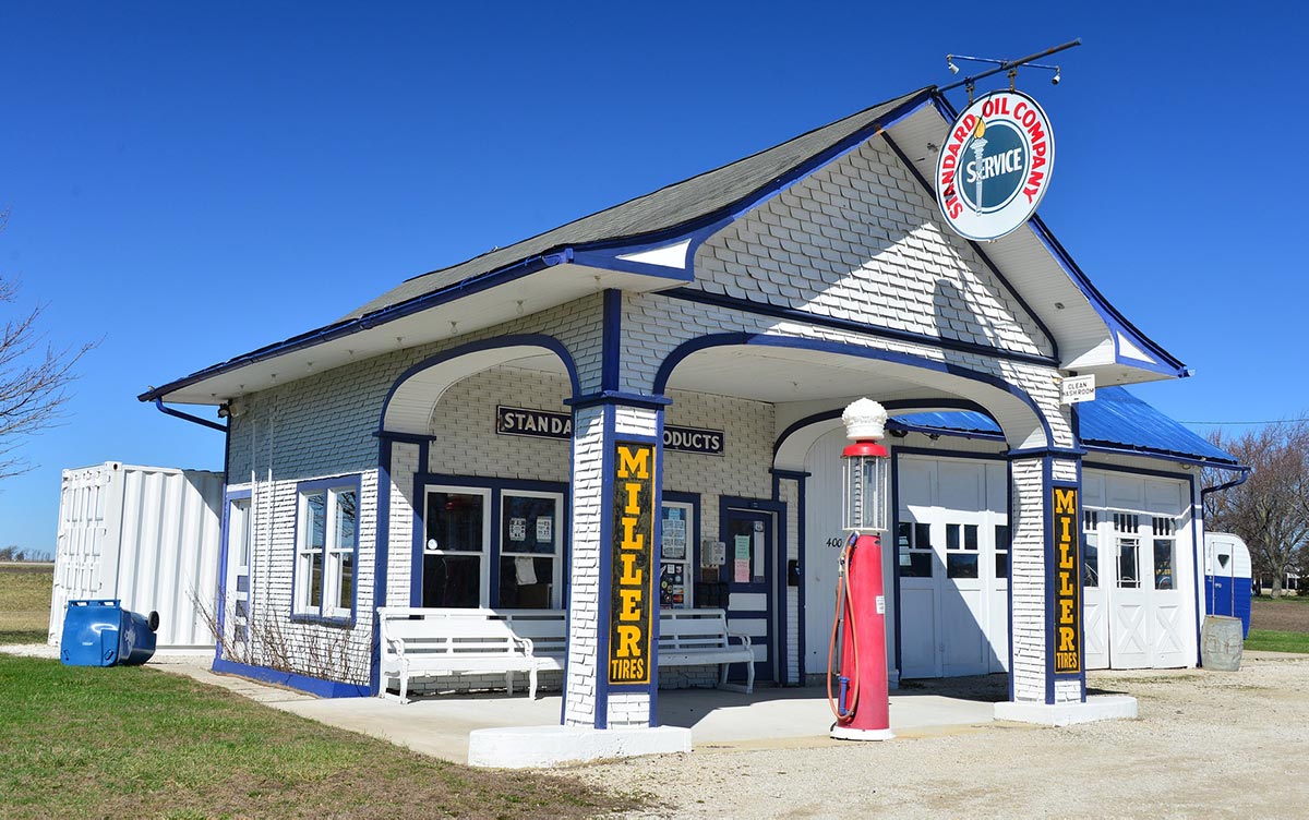
The efforts of the Route 66 Associations has led to a rise in tourism along the route. Many people are once again travelling along the highway to experience its history and culture. The route is lined with a variety of unique and quirky attractions including classic diners, historic motels, vintage gas stations and roadside curiosities.
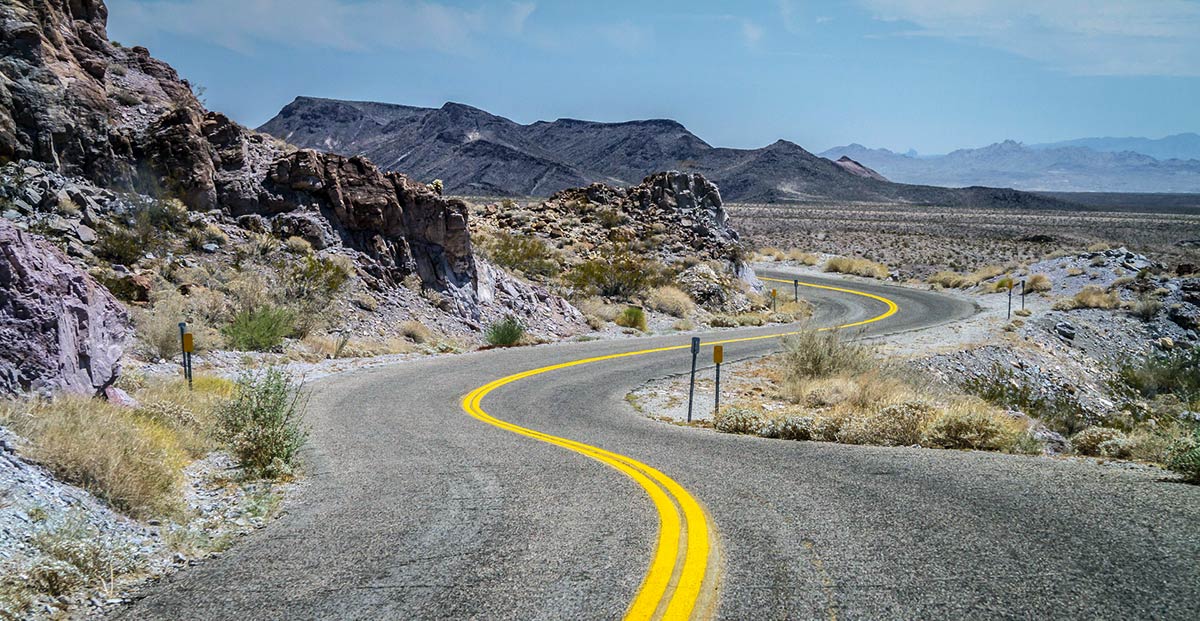
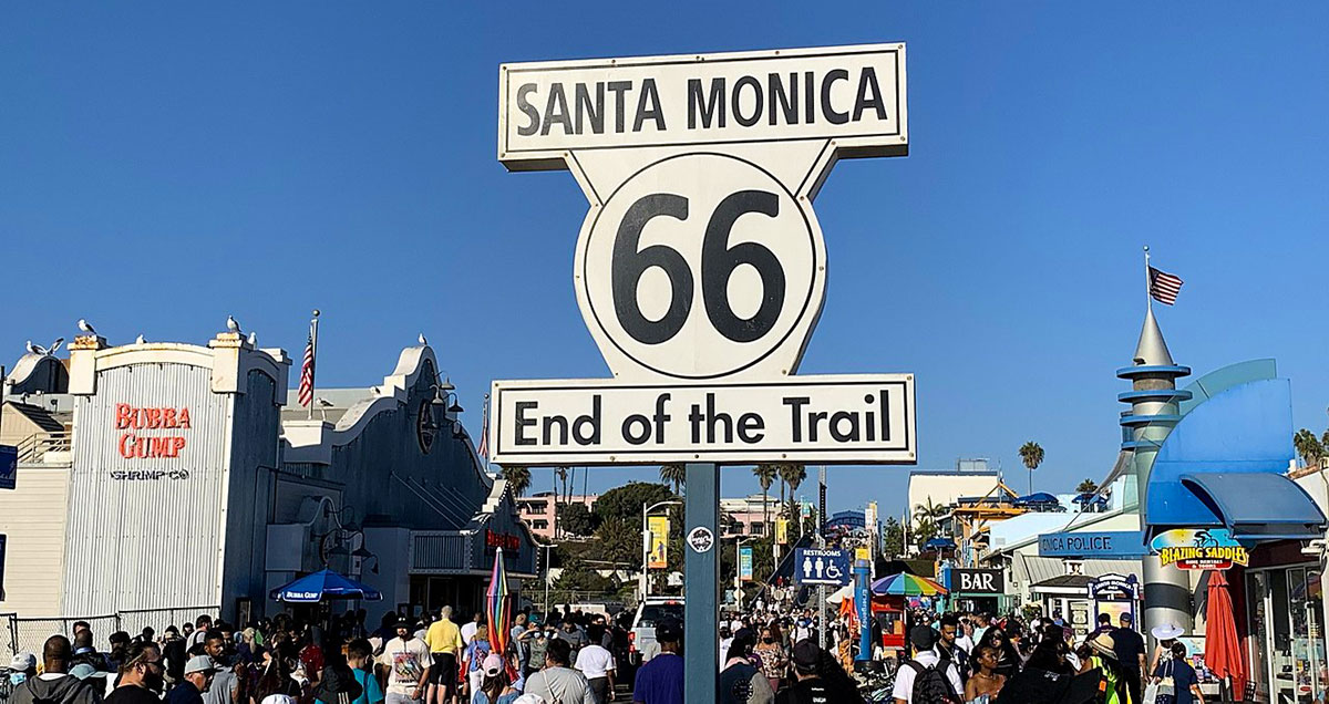
Many tourists choose to drive the entire route from Chicago to Santa Monica, while others opt to explore specific sections of the road, such as the famous Route 66 stretch in Arizona or the scenic drive through the Ozarks in Missouri. Current state maps do not show the routing of Route 66 as it was decertified in 1985. Nowadays, about 80% of Route 66 is still drivable.
One of the most popular attractions along Route 66 is the Grand Canyon in Arizona, which is located just a short detour from the route. Other popular stops along the way include the Cadillac Ranch in Texas, the Blue Whale of Catoosa in Oklahoma and the Santa Monica Pier in California.
The Disney Pixar movie Cars, released in 2006, is often credited with helping to increase interest in Route 66 and driving tourism along the route. The movie is set in a fictional town called Radiator Springs and features a variety of classic cars and other nostalgic elements that are associated with the highway.

In the years following the release of the movie, many businesses along Route 66 capitalised on the renewed interest in the route, with some even rebranding themselves as Cars themed attractions. This helped to further promote tourism and make it a more popular destination for road trippers and fans of Americana.
The legacy of Route 66 lives on, and it continues to inspire and captivate people from all over the world. While the decline of Route 66 has been a difficult chapter in the highway’s history, there is still hope for its future and many people are working to ensure that it remains an important part of American culture for generations to come.